About the proposed
Dunoon Dam
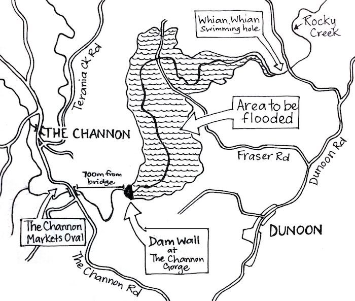
The proposed dam site
Rous County Council, who supplies bulk water to Ballina, Byron, Lismore and Richmond Valley council areas, proposed the construction of a 50GL dam between The Channon and Dunoon, on Wijabal Wia-bal land in Northern NSW.
The site is downstream on Rocky Creek from the existing Rocky Creek Dam
and would flood rainforest and eucalypt forest, farmland and Cultural Heritage sites.
The proposed dam would be 3.5 times larger than Rocky Creek Dam.
The proposed dam wall & infrastructure
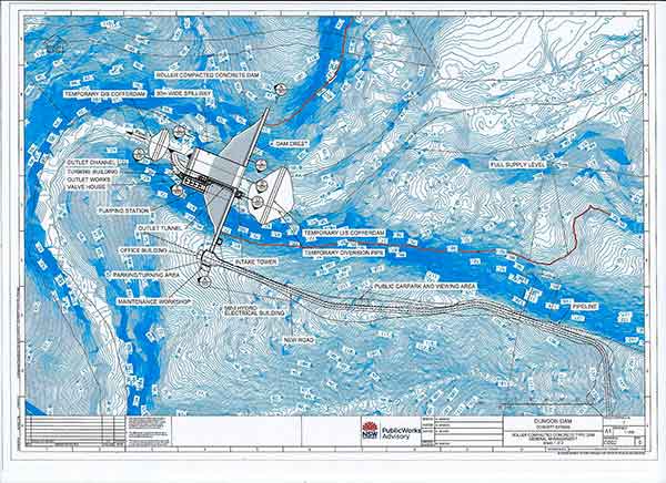
The 40m high roller-compacted concrete wall would be less than 1km from the well-known Channon Markets location.
The wall would be constructed in The Channon Gorge, which is the site of rare rainforest on sandstone.
Accompanying Infrastructure
The infrastructure accompanying the dam would include a 40m high dam wall, pumping station, a new access road linking from Dunoon Road, and a pipeline to take water to Dorroughby treatment plant.
The pipeline would in partial run through the Dorrobbee native grass reserve which has been managed for millennia by the Widjabal people. The Dunoon dam poses a major threat to Widjabal Sacred sites including burial sites, which would be flooded in the dam inundation area.
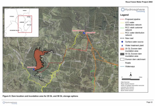
From Terrestrial Ecology Impact Assessment 2011
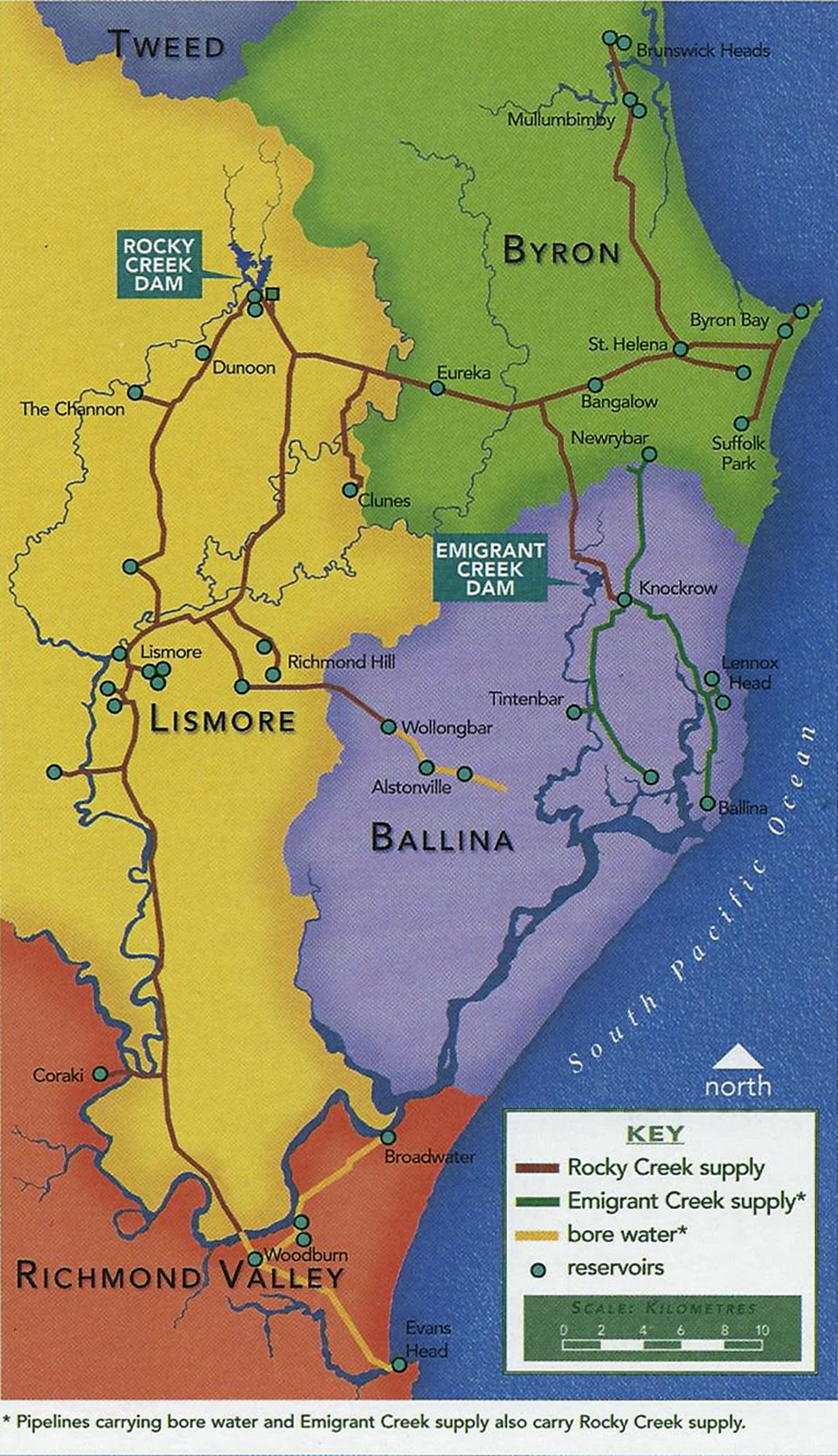
The Rous water distribution networks
The next two images are from the Rous Water publication in 2005, The Water Walk – A User’s Guide to the Far North Coast Water Cycle.
This first map is the water distribution networks of Rous County Council.
It explains where the water from Rocky Creek and the proposed Dunoon dam would go to.
You can see it being supplied to all four LGA’s: Lismore, Byron, Ballina and Richmond Valley.
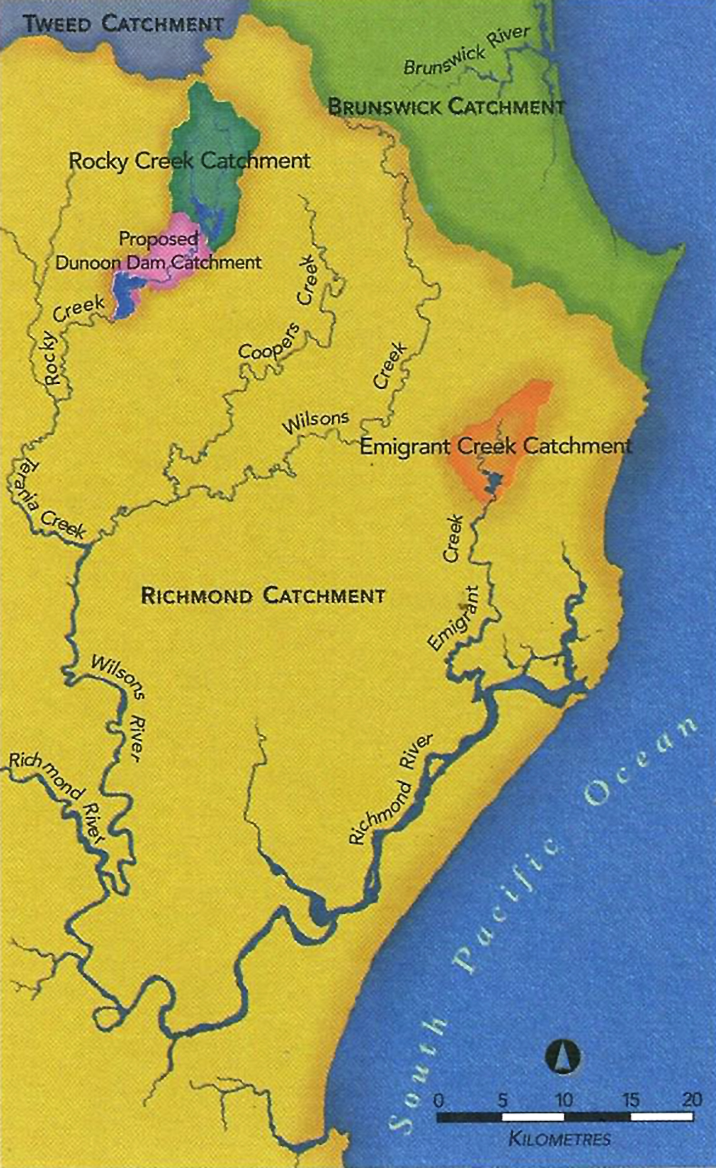
Water catchment comparisons
This second map is the water catchments of the Rous County Council area.
It shows:
1. the massive area (in yellow) that is potential catchment for free water falling from the sky, if only it could be captured. This needs serious investment from Rous and from the four local governments to help water users collect and store their own water wherever possible.
2. the large catchment (in dark green), for the existing Rocky Creek Dam, all of it forested and protected and producing high quality water.
3. the comparatively tiny catchment for the proposed Dunoon Dam (in pink), most of it farmland of which half is macadamia farms releasing large amounts of chemicals into the soil runoff.
In addition, the new dam would receive water from the forested mountain catchment only when Rocky Creek Dam overspills. The new dam may take years to fill and in drought would receive nothing because dry soil doesn’t produce runoff. Meanwhile tanks can fill in drought even from a few showers.
